Bolzano with SkyAlps: a new route from Prague – not just for aviation enthusiasts
289 €


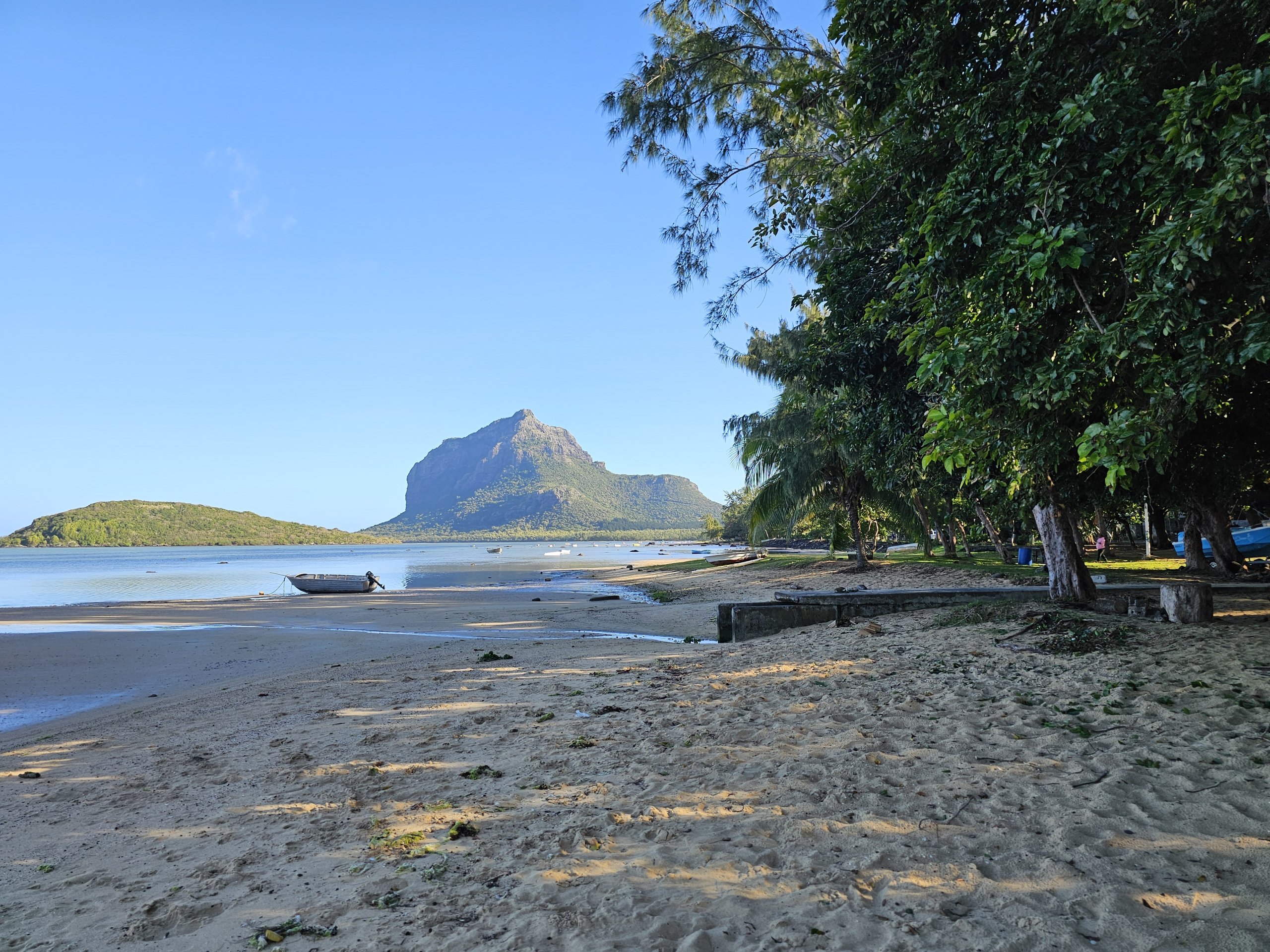
Mount Le Morne Brabant is an absolute icon of the island of Mauritius and has a huge cultural significance for the locals.
The view of the monumental rock massif is one of the world's most famous and a visit to Le Morne is a definite "must-do" during a stay in Mauritius.
Top 10 luxury resorts in Mauritius
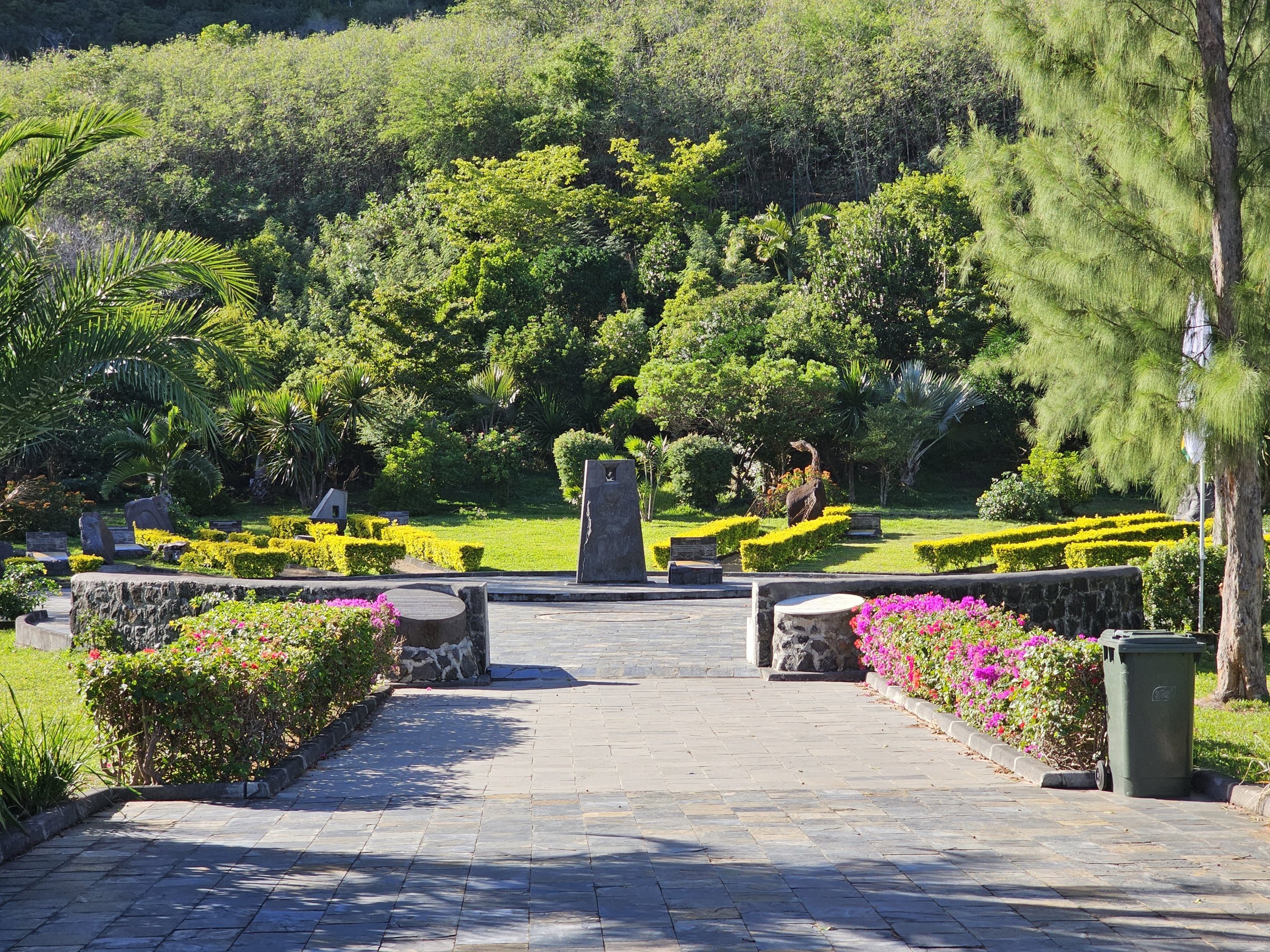
Le Morne Brabant is not just a mountain, but has far-reaching cultural overtones. According to locals, Le Morne embodies the determination for freedom of the escaped slaves of the 18th and 19th centuries.
It was the peninsula, of which the mountain occupies a large part, that became the refuge of a huge group of slaves fleeing captivity at this time.
This is one of the reasons why the mountain is listed by UNESCO not as a natural but as a cultural monument.
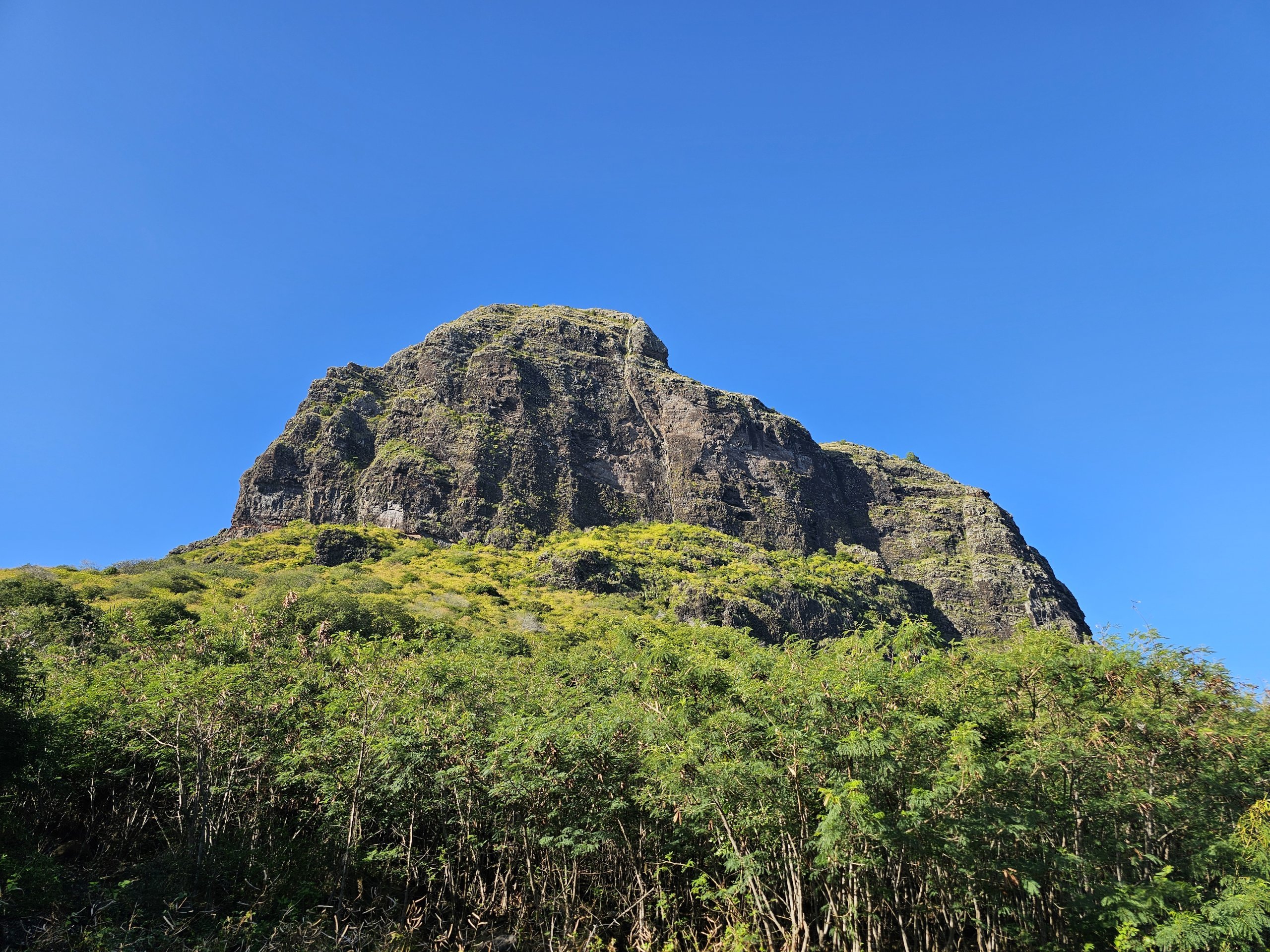
The top of the mountain rises to 556 metres, which may not sound impressive, but the climb really starts directly from the sea, i.e. from 0 metres.
It's impossible to climb to the very top without climbing gear and experience, and in fact climbers don't often climb directly to the summit either.
The highest point where ordinary hikers head is the Le Morne Cross at 370 metres. And it was to this cross that I went.
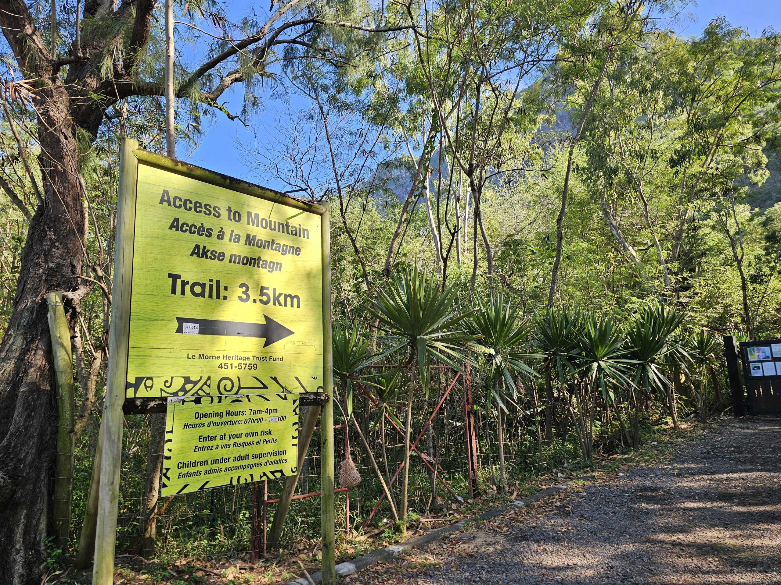
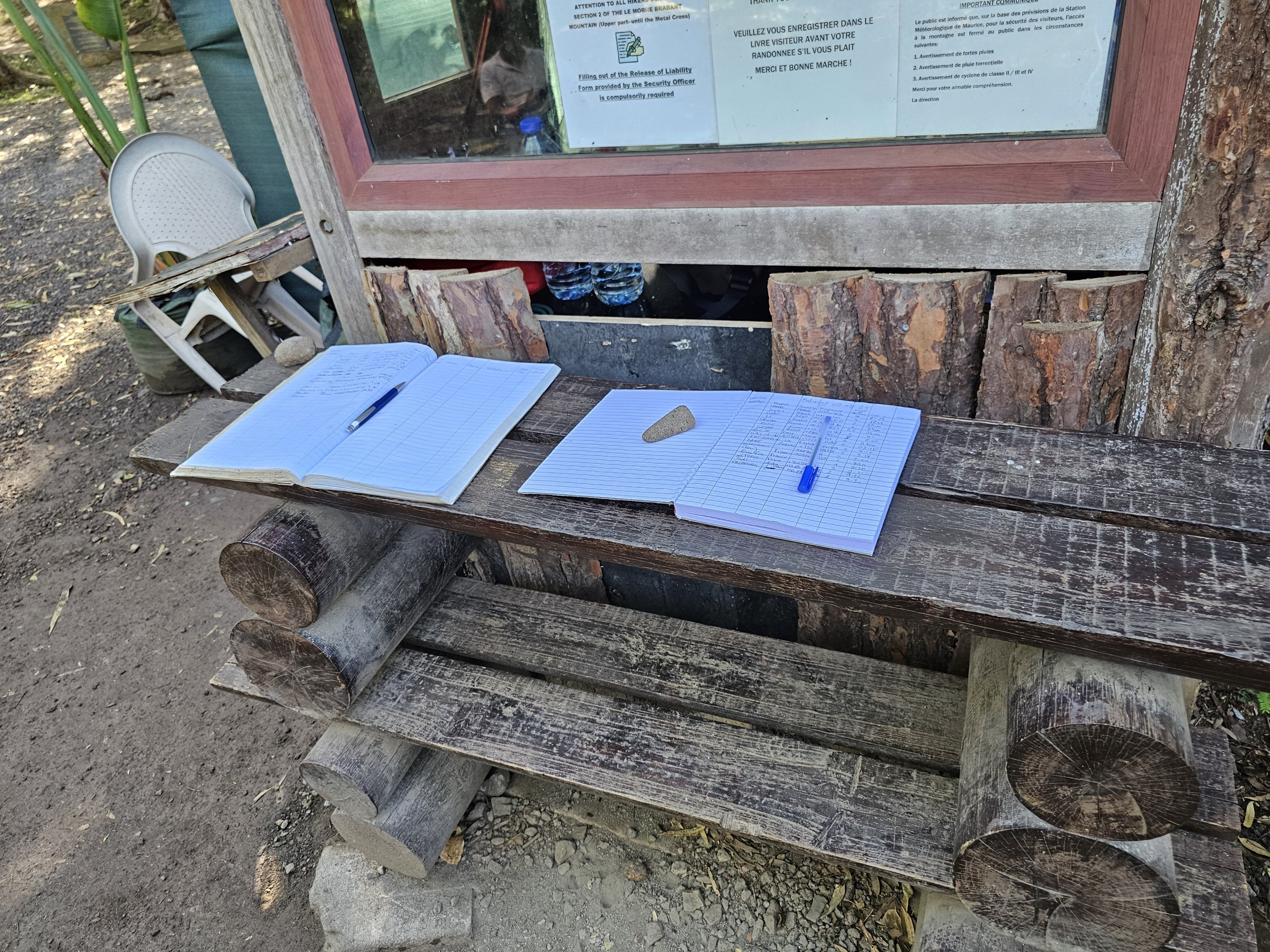
Before entering the only official route, you sign a book at the reception. Just write your name, your contact details and the time of the start of the climb. When you return, you'll write the time you left the mountain next to your name.
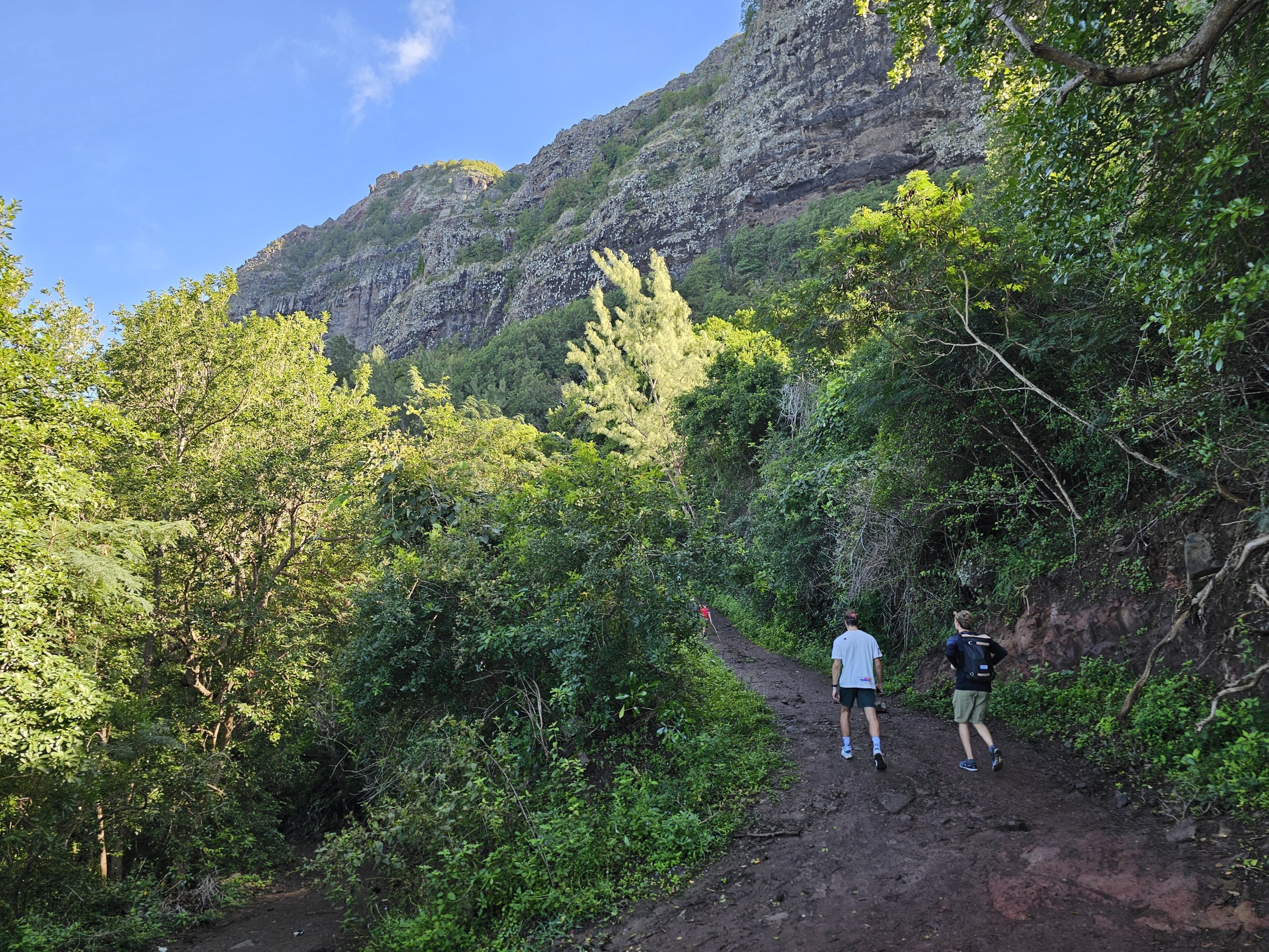
The first half of the route is on a comfortable and fairly wide trail, which is uphill but can be easily managed by less trained hikers.
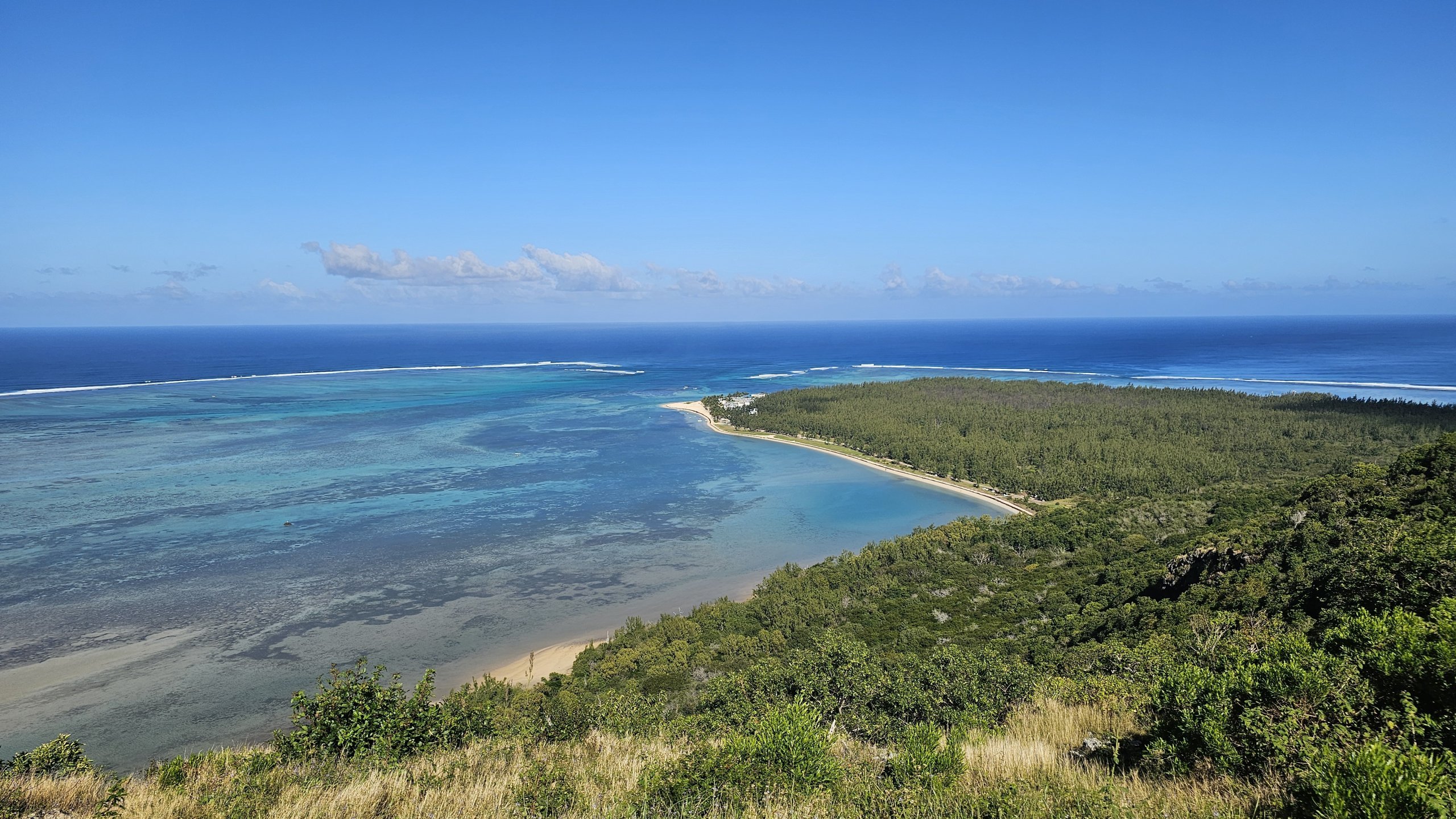
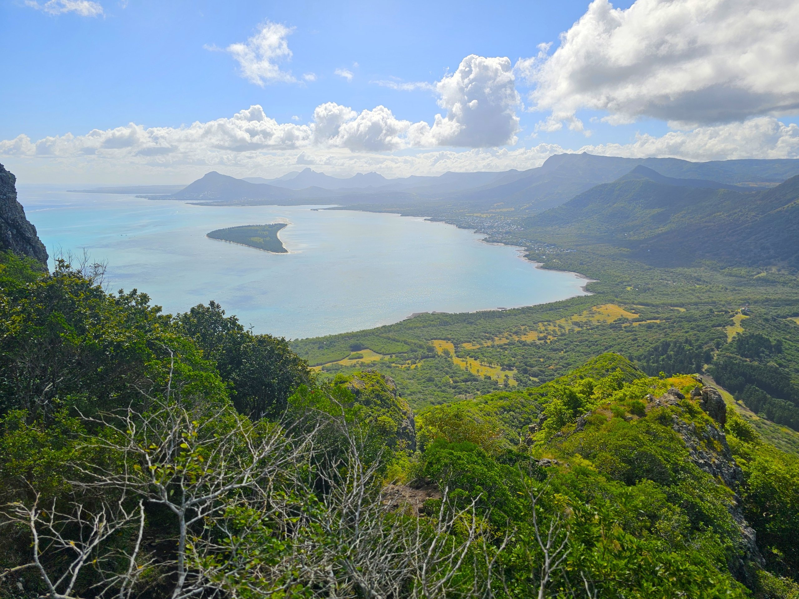
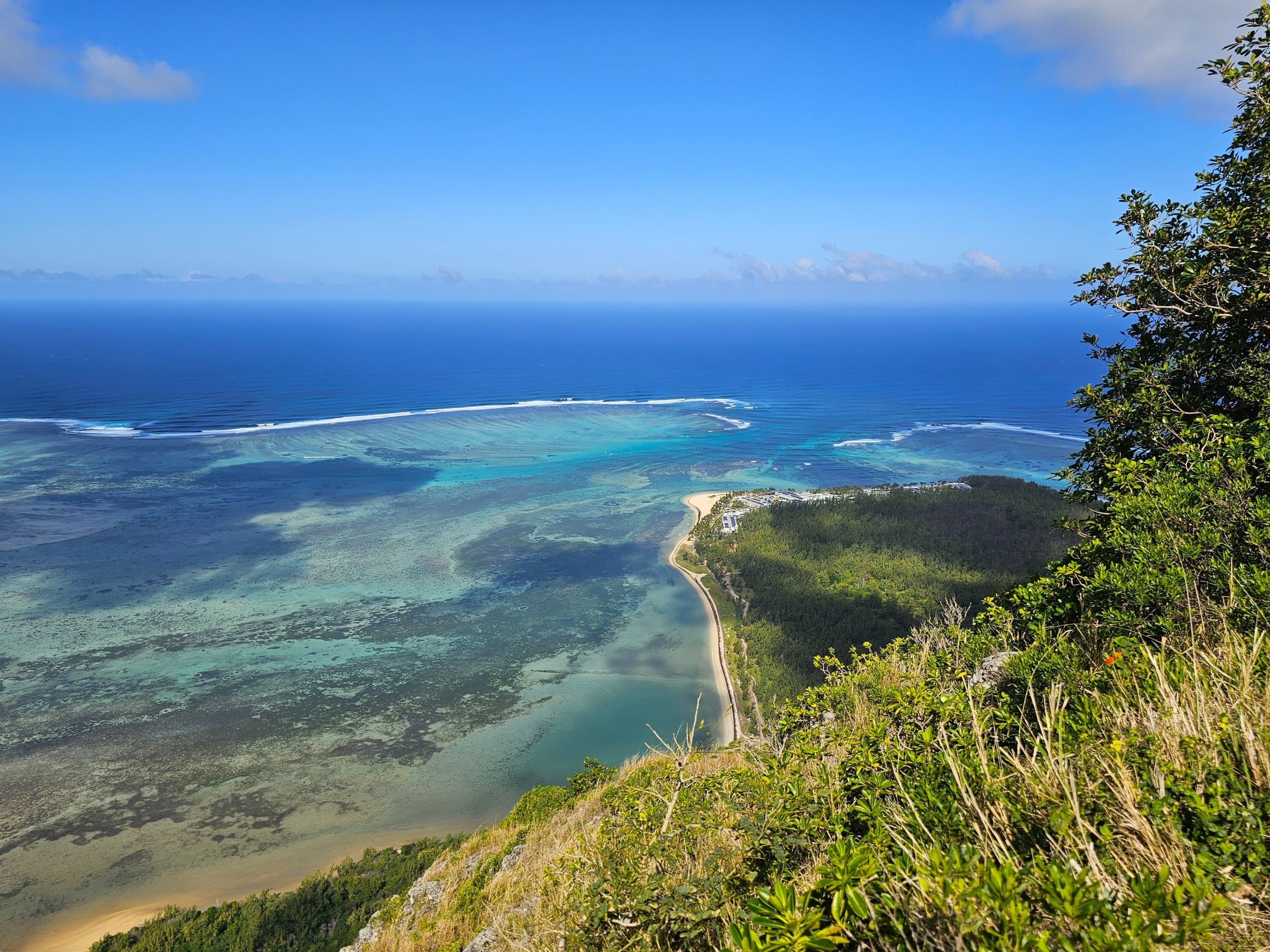
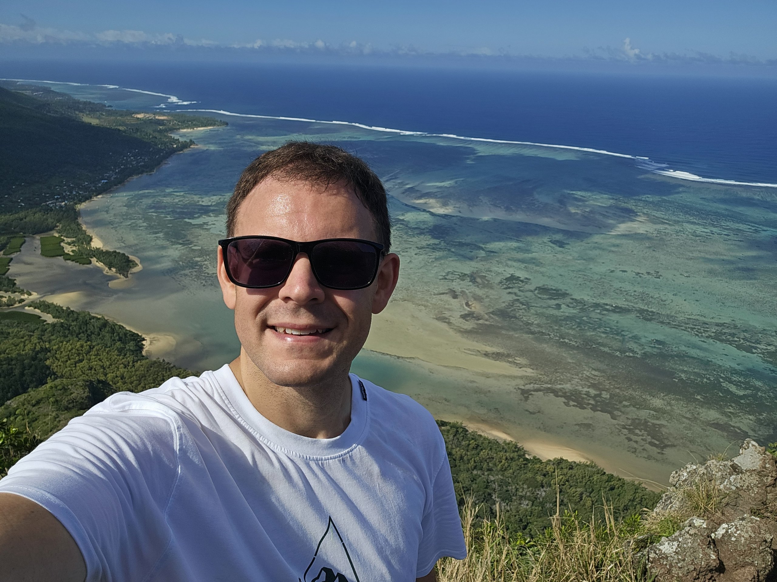
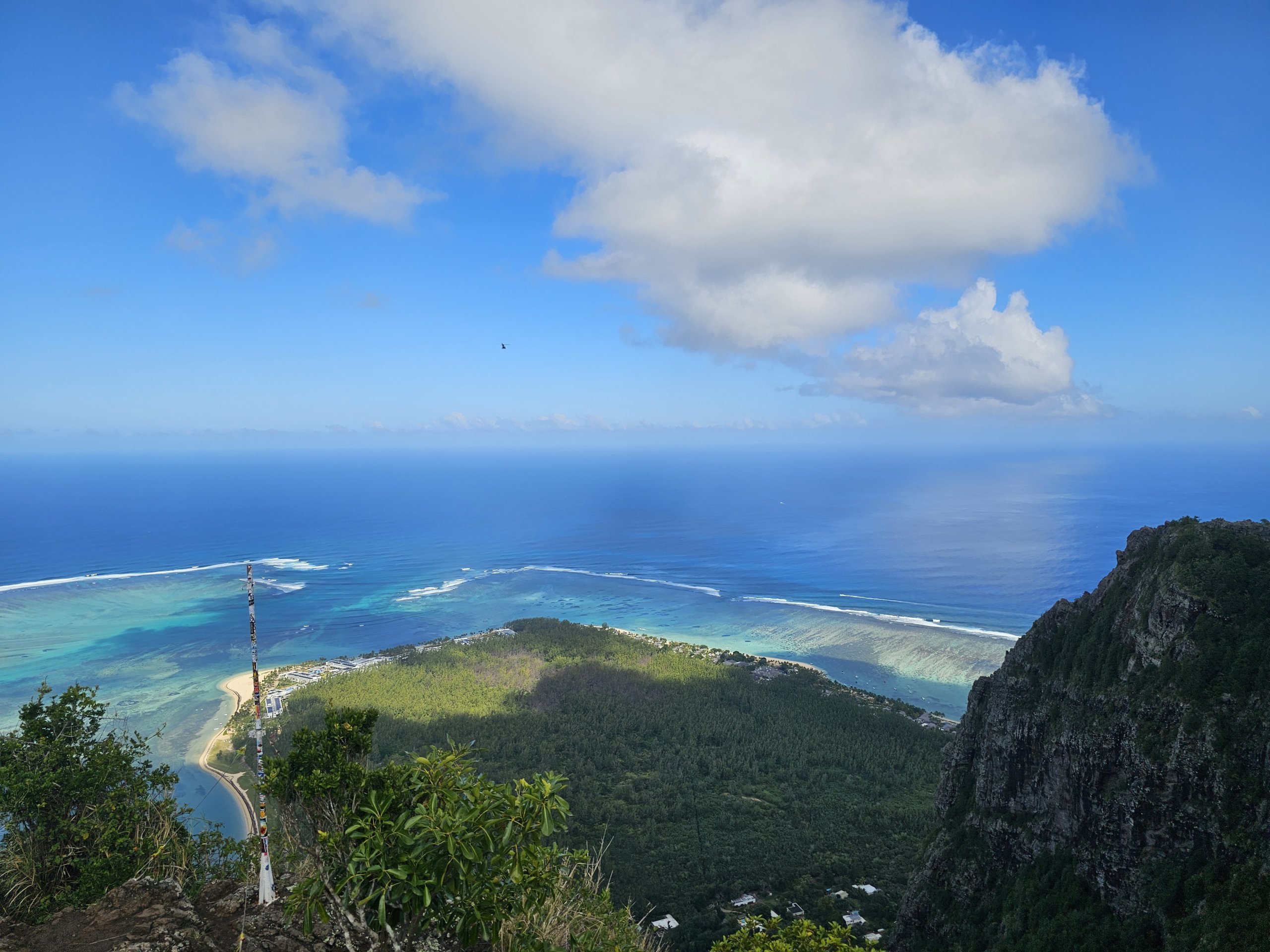
After about 25 minutes of brisk walking, you will reach the first viewpoint, where you will have a spectacular view of the lagoon with the Kitesurfing Beach and the south coast.
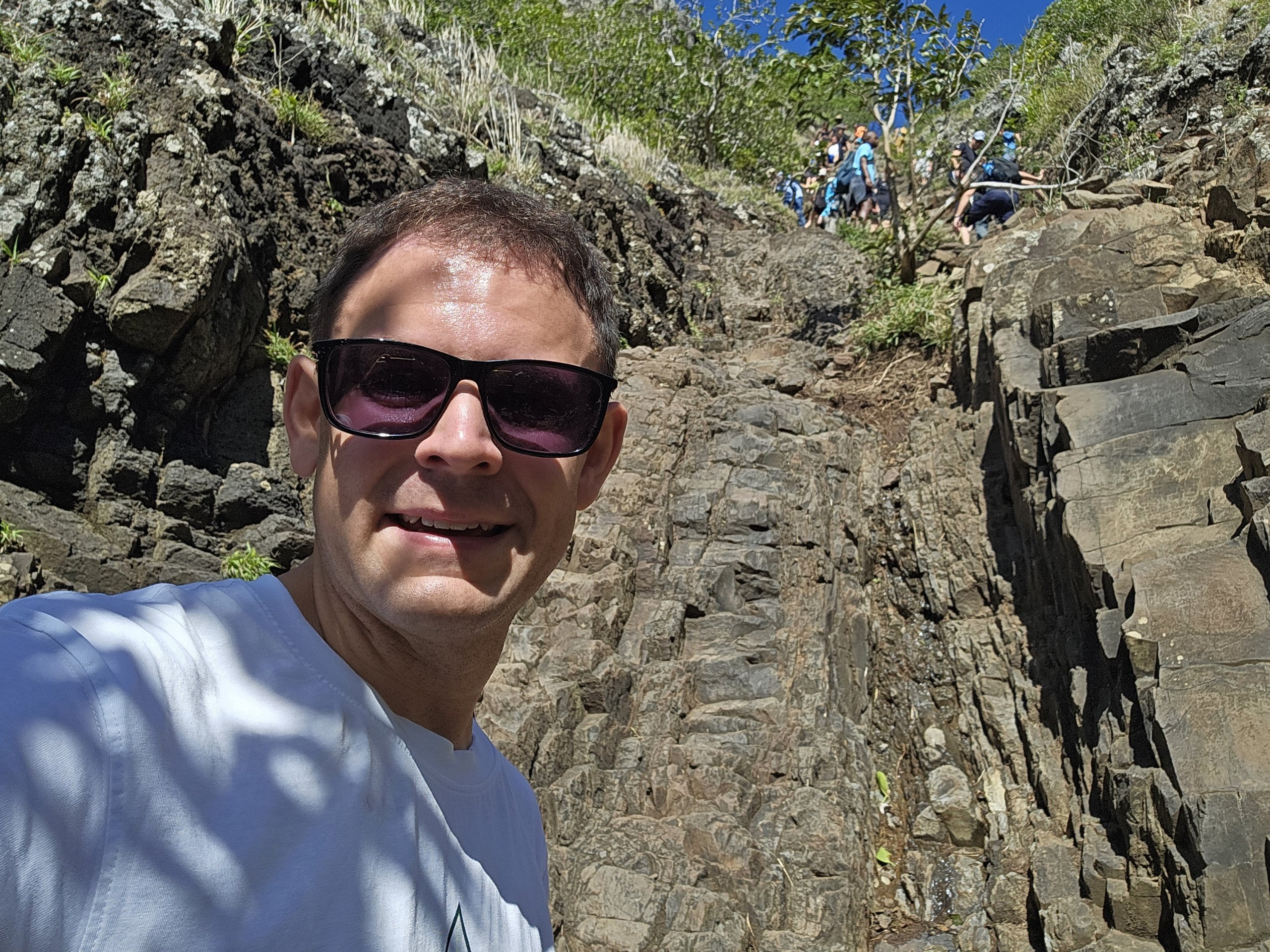
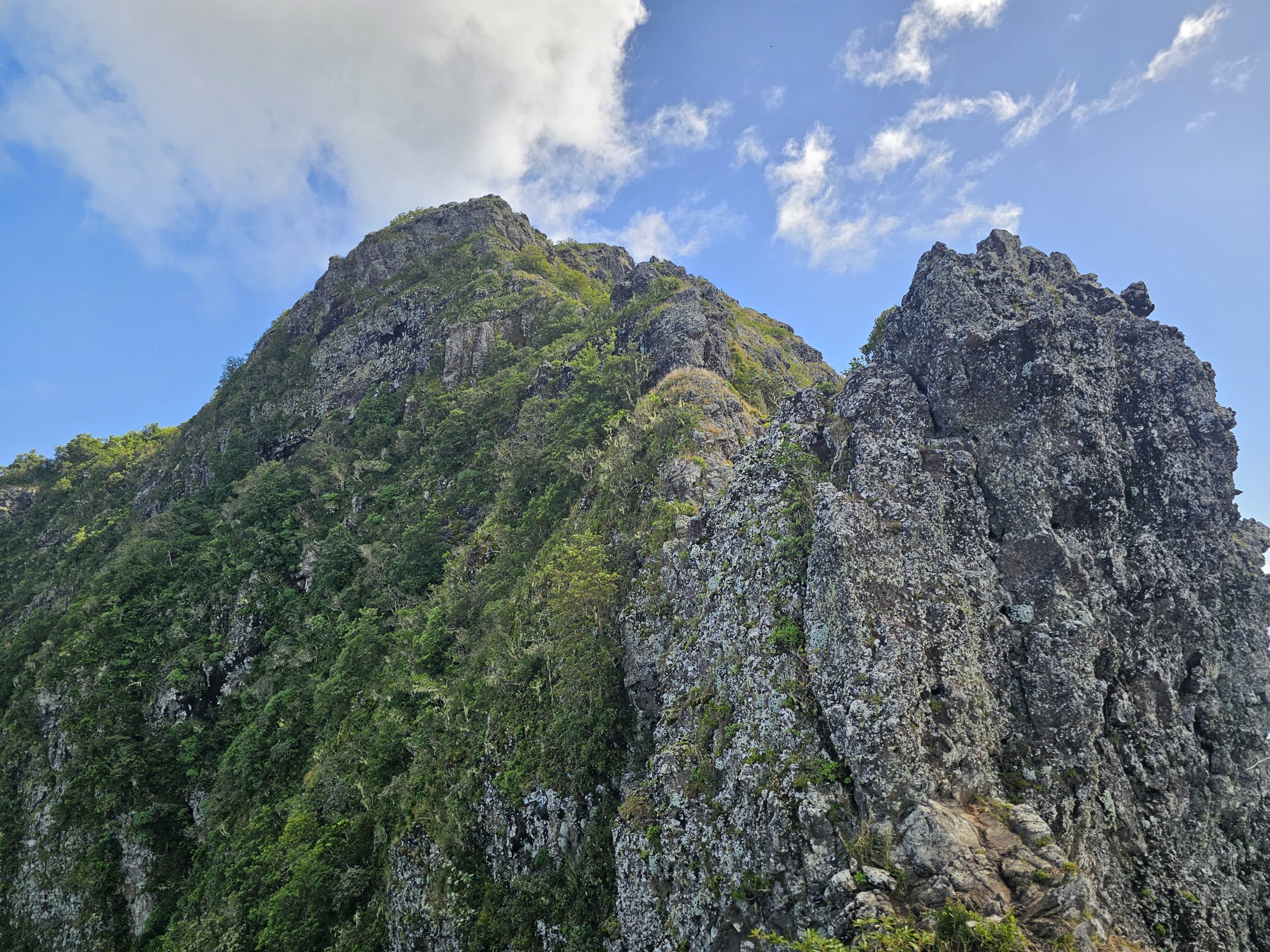
From this point on, the path becomes much more challenging. I pass a warning sign and looking up, it is clear that the text on the sign must be true!
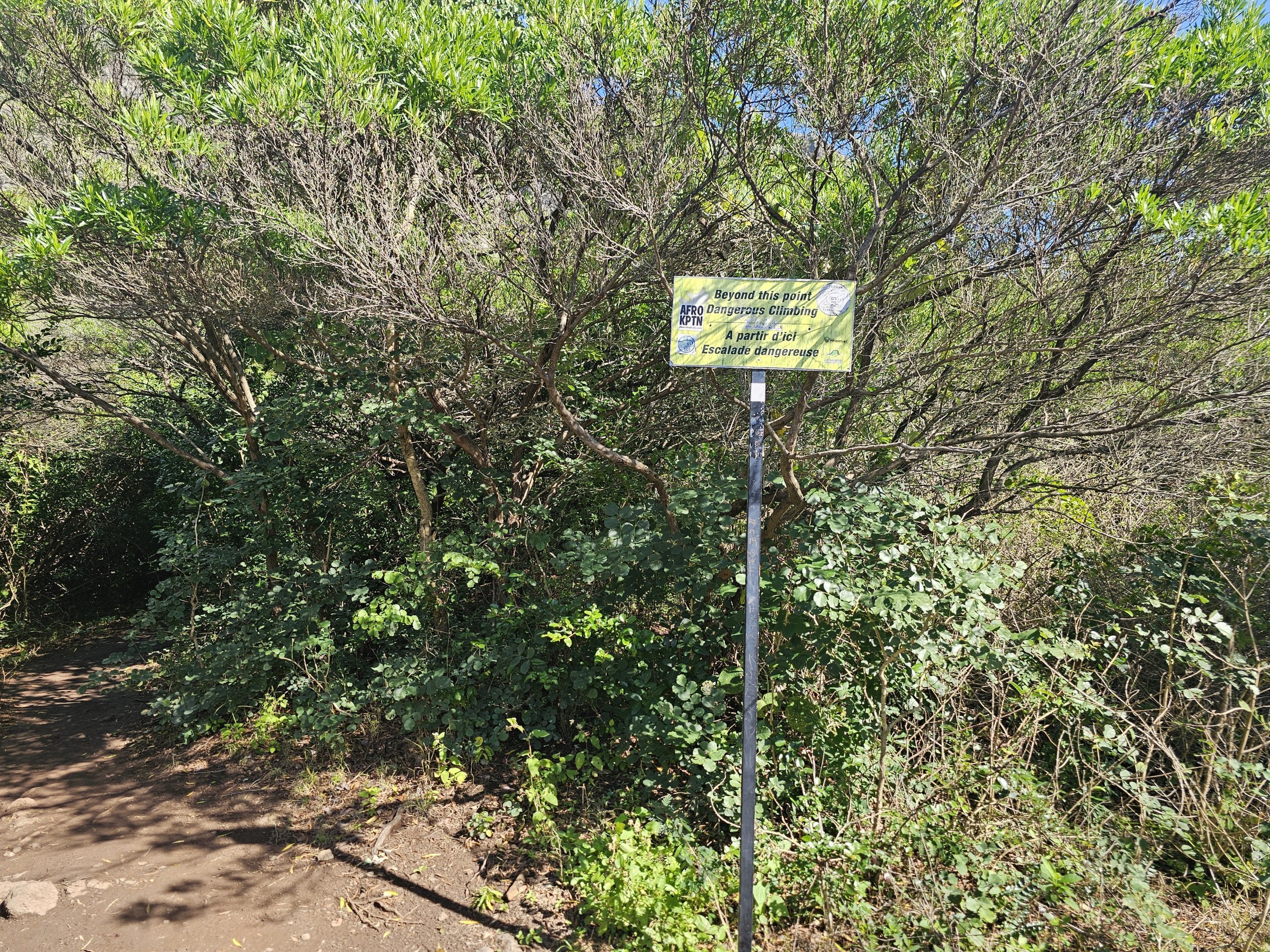
After less than 5 minutes of normal walking, the first climbing section comes up the rocky wall.
You don't need any climbing equipment and the rocks are stable and serve well as holds, however this section is no longer suitable for people with vertigo.
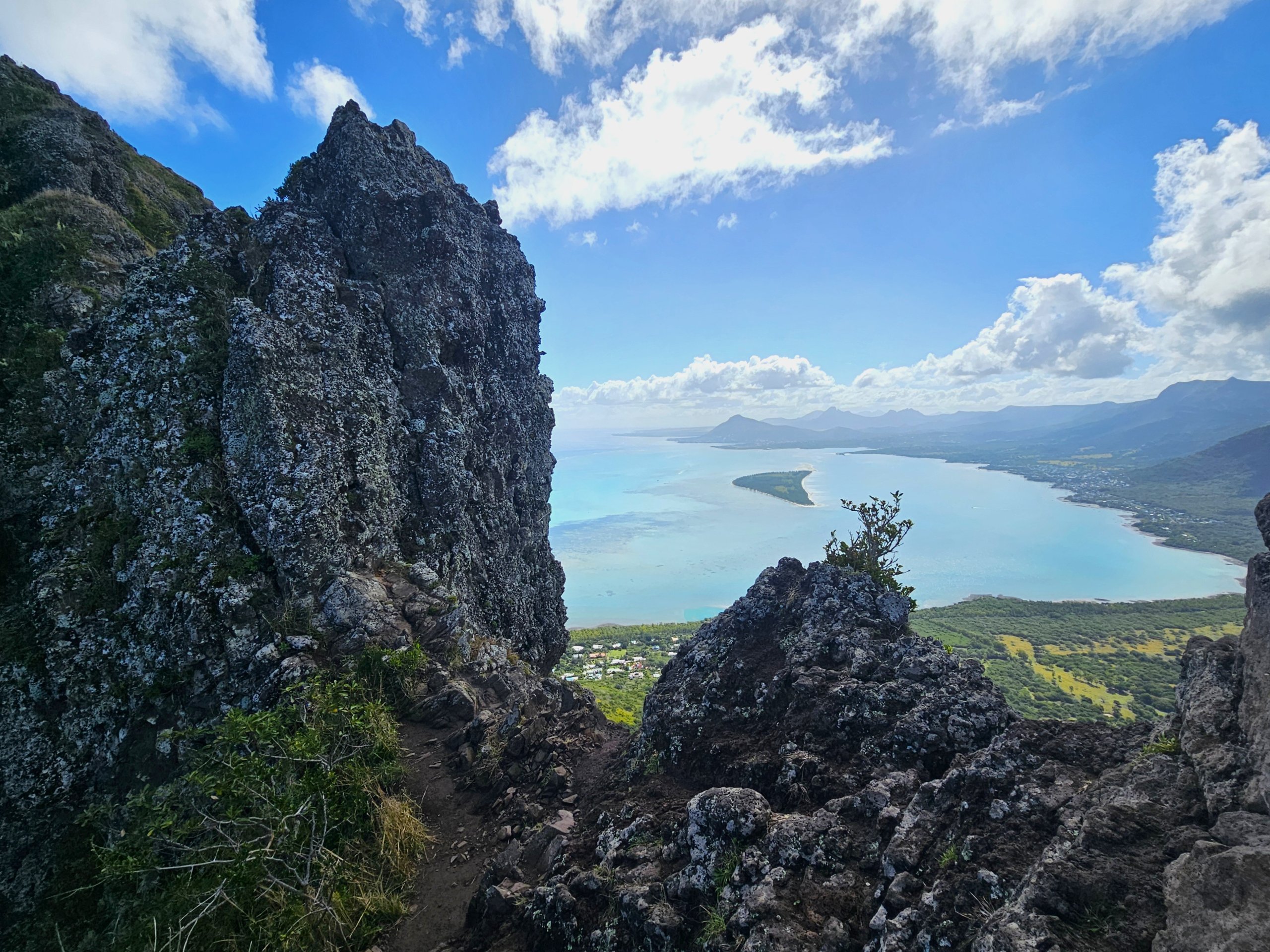
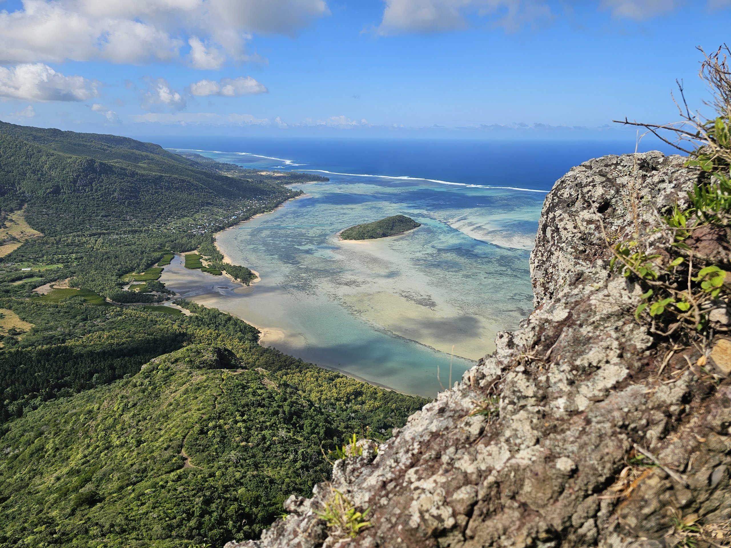
After climbing the rocky passage, I choose a quick reward in the form of the 2nd lookout, where for the first time you get views not only to the south, but also to the north and west coast of the island.
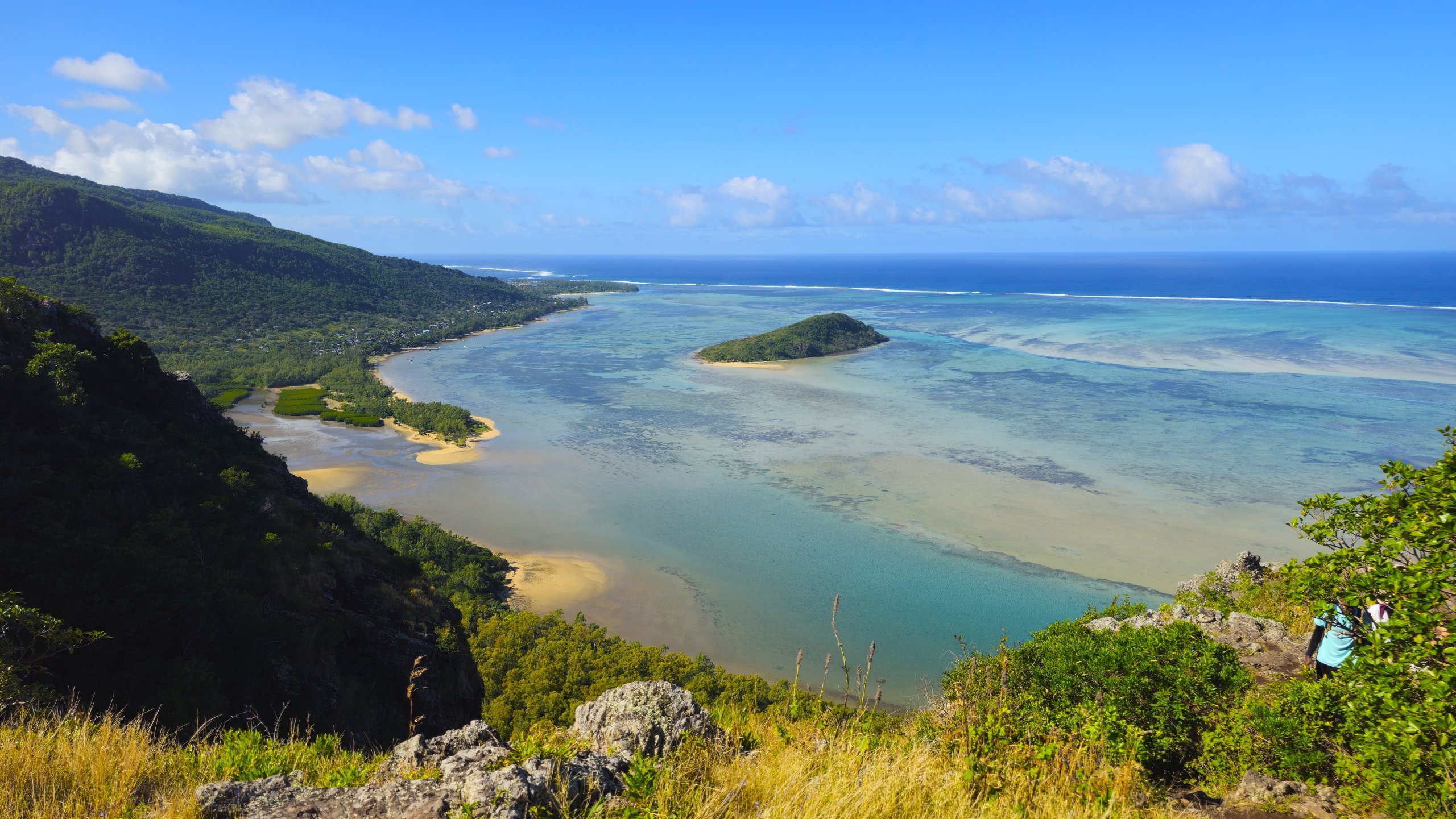
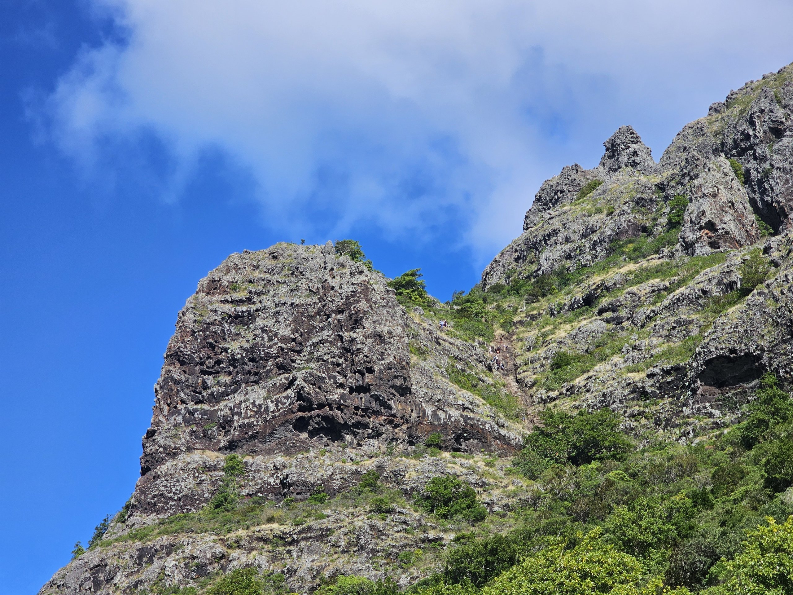
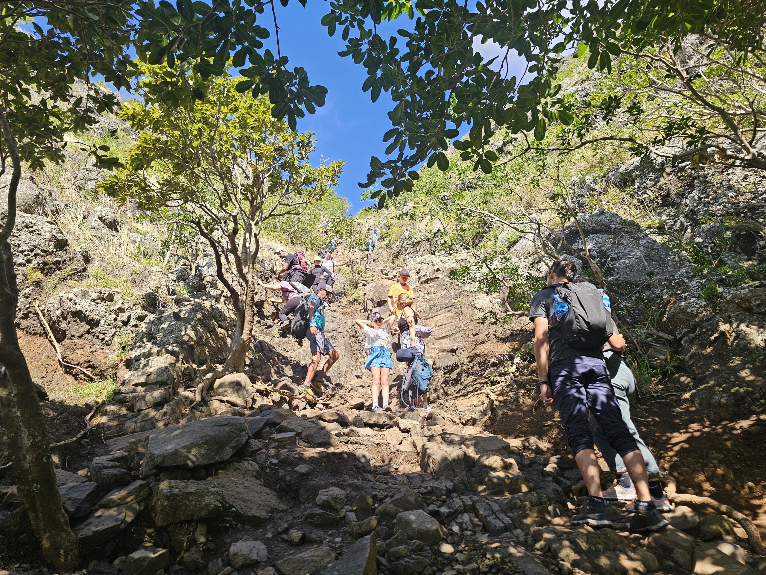
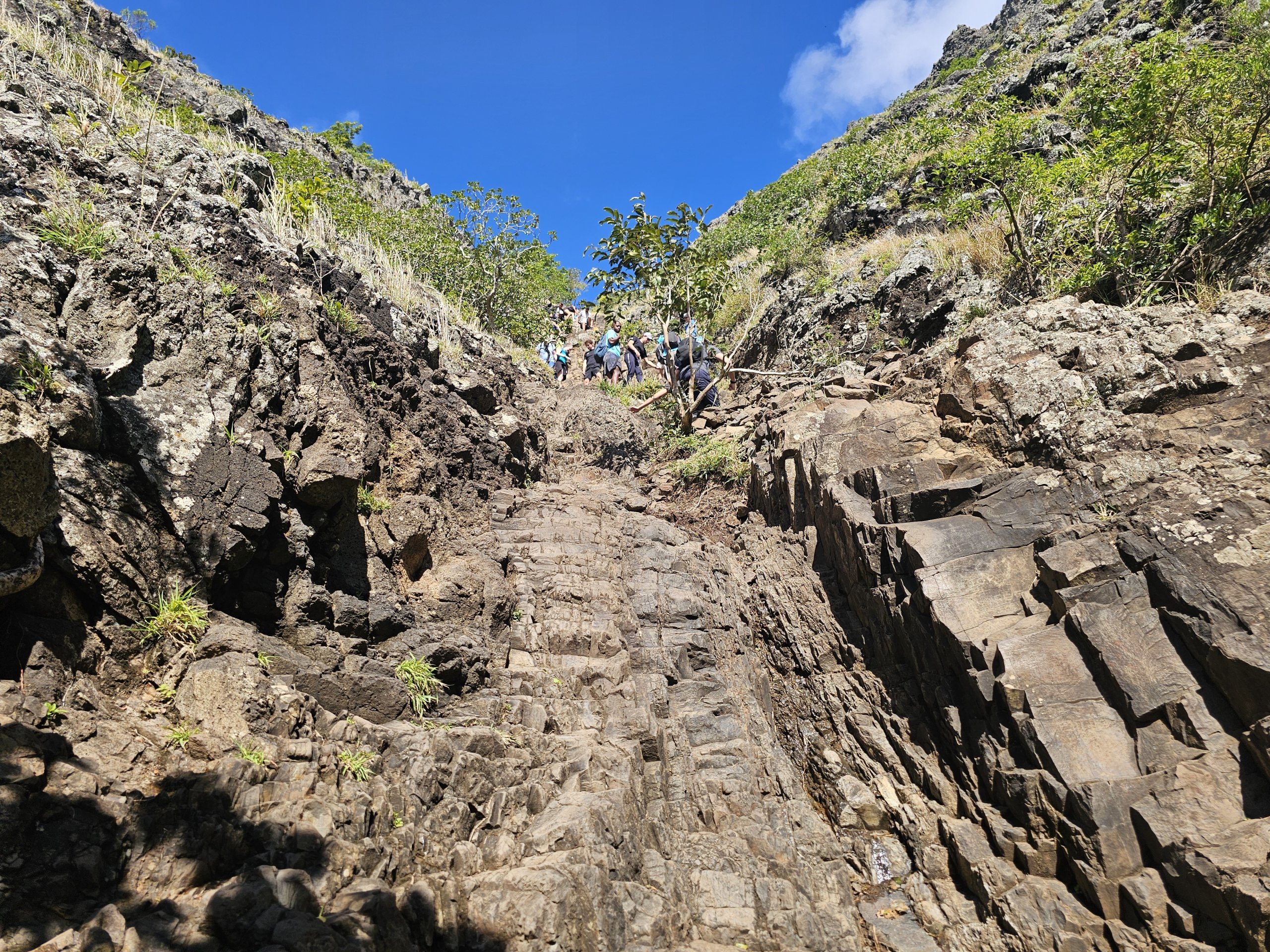
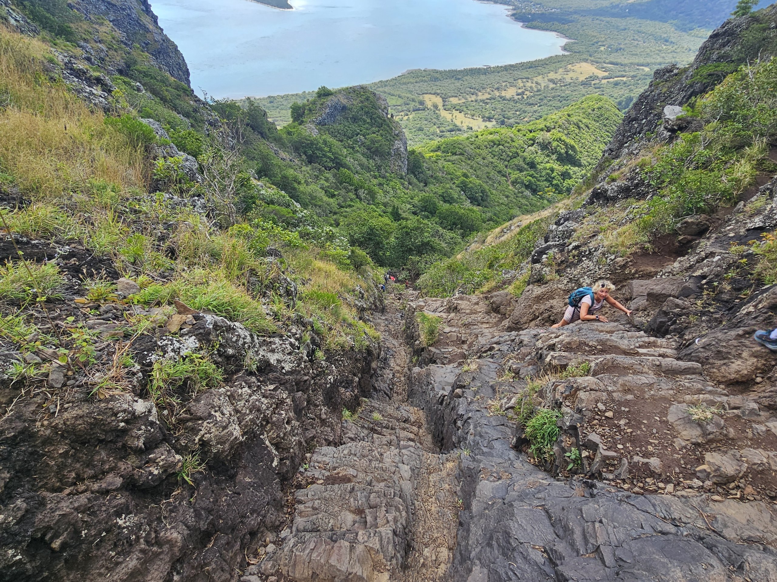
From here on the route continues with similarly challenging rocky paths, where you have to use all 4 limbs, until you reach the 3rd viewpoint, which has so far surpassed all the previous ones.
For a while the path seems to be getting more comfortable, but the most challenging section is yet to come.
Fortunately it's already quite short, so you won't get too physically exhausted here, but good stability is an absolute must. The rock here is unprotected by anything and looking down can be a real problem for people with vertigo!
But the top with the metal cross is within reach. There isn't much space around the cross, so it's permanently crowded, but despite that I stay here for 30 minutes.
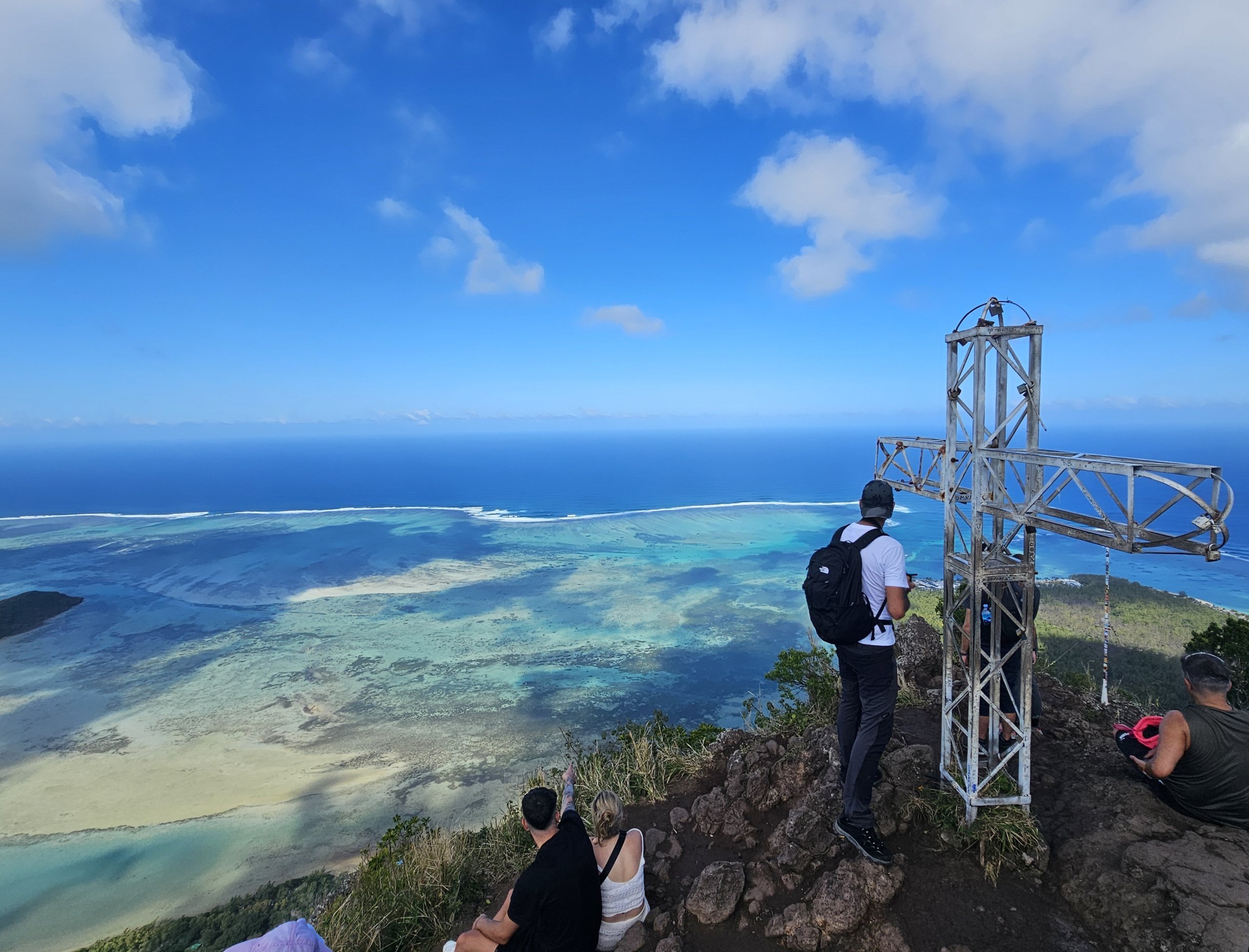
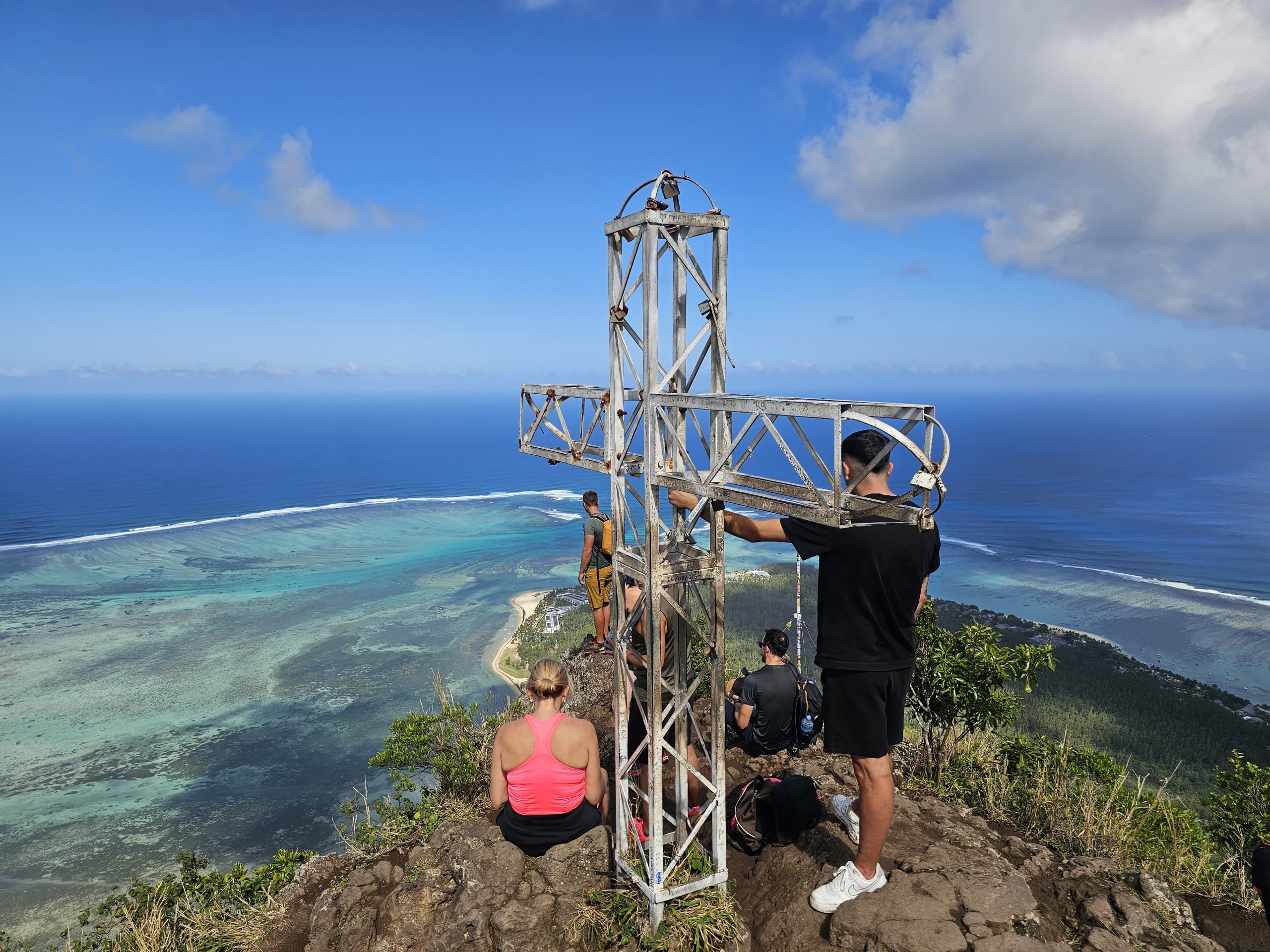
From the cross you can also see the real top of the mountain, which is 200 meters higher and there is no way to get to it.
The descent down is even more technically challenging for me than the climb up, but I manage it a bit faster and without major problems.
In total, from the parking lot to the top at the cross, you cover about 370 vertical meters over a distance of 3.5 km.
In total you will walk 7 km.
It took me just under 1.5 hours to climb the mountain and about 1 hour to descend. I stayed another 30 minutes at the top.
So in total, the visit to the mountain took 3 hours, but I am used to walking on mountains and usually have a slightly faster pace than others.
So I recommend to count on 4-4,5 hours when climbing up to the cross.
The public hiking trail is open from 7:00-16:00. To reach the top, you must start the climb at around 13:00 at the latest.
Entrance to Le Morne Brabant is free.
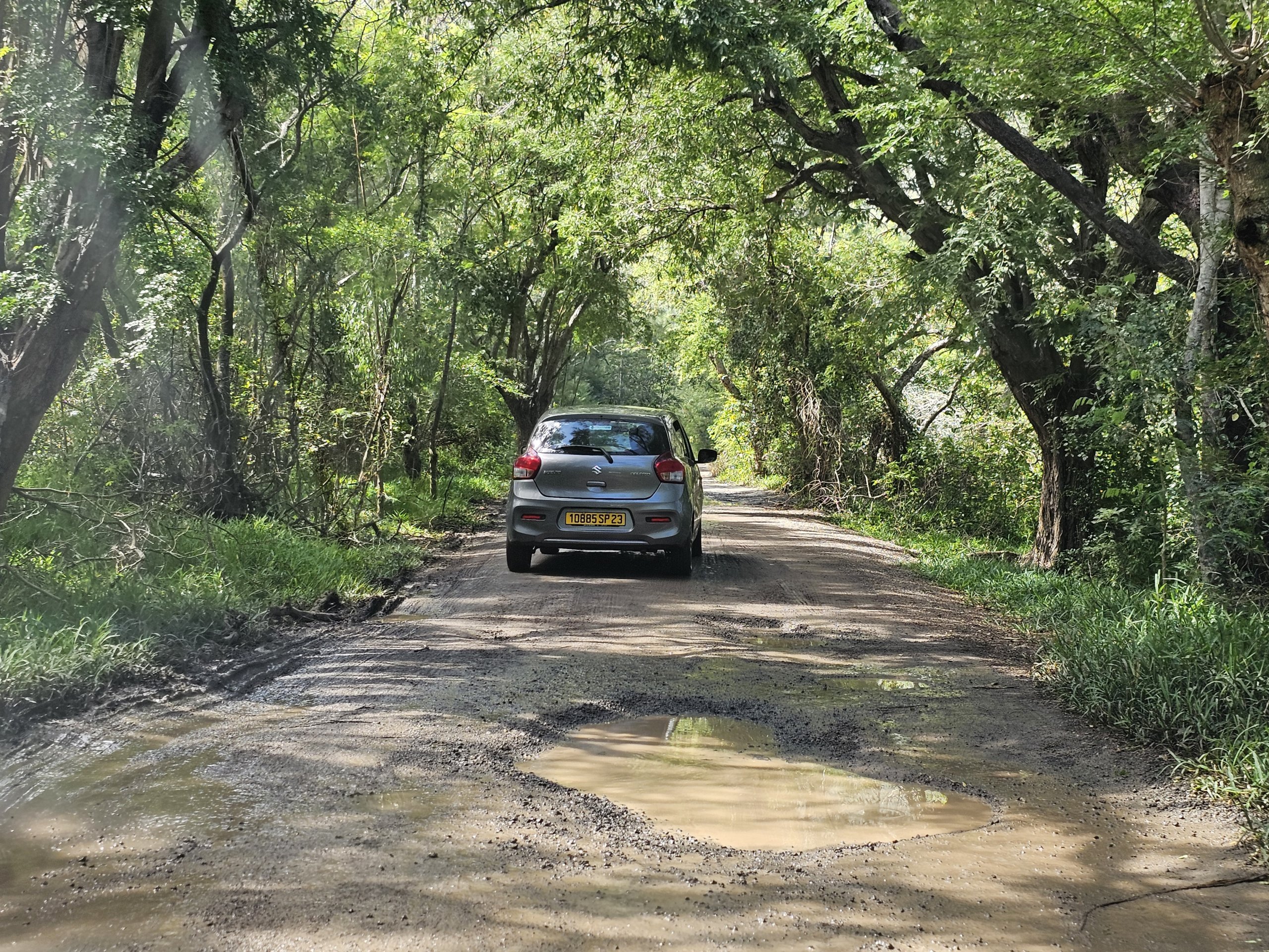
There is a free car park at the starting point, which is reached by a fairly broken unpaved road. However, it is passable for all types of cars with care.
Compare car rental prices in Mauritius
I had rented a small Suzuki Swift and managed to navigate the muddy road without any problems after the previous persistent rain.
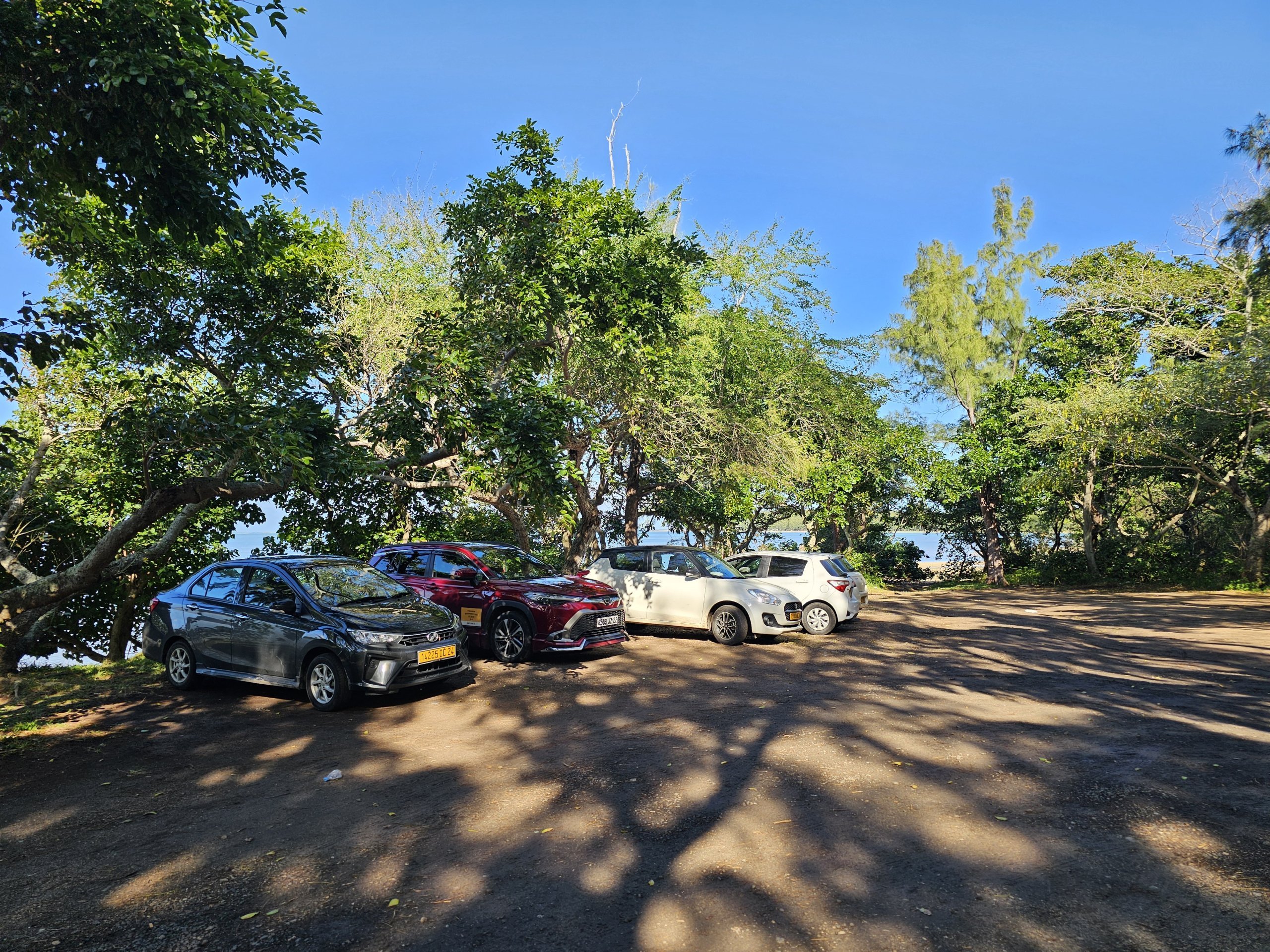
The car park can be accessed from two directions.

Here we add our map of the access routes by car and the only official hiking trails to the summit or to the cross.
Planning an early morning hike and don't want to travel from further afield?
Here are our tips for the nearest hotels within a 20-minute drive.
Discover all the places to see in Mauritius.
If you have any questions or comments about the article...