Lagoa das Setes Cidades
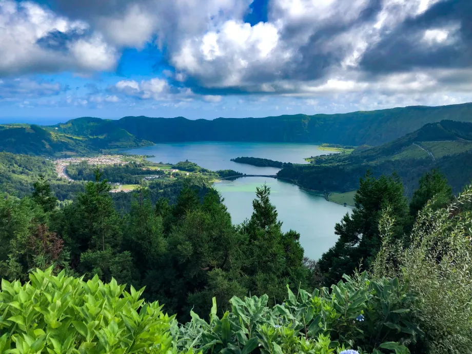
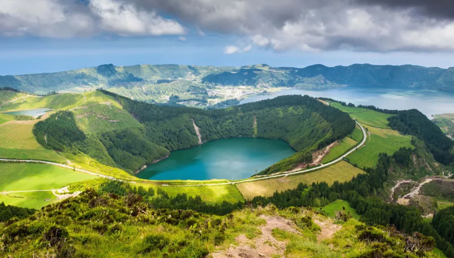
The huge crater of the dormant volcano, more than 2 km wide, called Sete Cidades (Seven Cities), is one of the most popular and beautiful places in the Azores. About half of the crater's floor area is filled by the largest Azores double lake, Lagoa das Setes Cidades.
Choose a hotel in São Miguel with a discount
A visit to the lake is one of the Azores' "must-sees" and although it's quite a touristy place, you definitely shouldn't miss it. On the shores of the lake lies the eponymous town of Sete Cidades, a popular tourist centre.
Lagua Azul, Verde or Sete Cidades? 1 or 2...?
The body of water, which covers an area of over 4.3 square kilometres , is divided into two different lakes: the larger Lagoa Azul (Blue Lake) and the smaller Lagoa Verde (Green Lake). Even from a biological point of view, these are bodies of water with completely different ecosystems and the differences are visible at first sight.
Due to the different depths and slightly different mineral composition, Lagoa Azul has blue coloured water, while Lagoa Verde has green coloured water. This is logically where their names come from.
In reality, however, it is a single lake, almost divided in half by the land, but there remains a channel about 50 metres wide across which a low stone road bridge leads.
In any case, Lagoa Azul and Lagoa Verde together form one large lake, Lagoa das Setes Cidades.
Hiking around the lake
Right around the shores, there are short walks through a beautiful green landscape of cultivated meadows, fields and small coniferous groves. The short walks are often unmarked, but you'll find plenty of them along clearly beaten paths and especially around Lagoa Azul.
While the east and west sides of Lagoa Azul are ideal for flat paths and picnicking, the north side impresses with a monumental crater wall up to 300 metres high and almost perpendicular, creating a mystical setting.
A similar situation, only mirrored, prevails around Lagoa Verde. Several paths run along its edges through forests and meadows, but the southern part of the lake is impassable thanks to the huge perpendicular slopes of the mountains.
A scenic route along the edge of the caldera
One of the best known and most popular hiking trails follows the rim of the crater 150 to 200 metres above the lake and the town of Sete Cidades. The officially marked trail doesn't go all the way around, but if you want to take a circular hike, you can easily walk a short distance on unmarked trails.
There are two main hiking trails that will take you to the best viewpoints in the Azores.
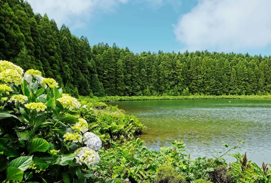
Miradouro Boca do Inferno and Lake Canário
The route starts in the centre of the town of Sete Cidades and follows a steep but relatively comfortable path to the northern top of the caldera with breathtaking views of Lago Azua, which it circles and crosses the top of Pico da Cruz to reach one of the most famous Azores viewpoints , Miradouro Boca do Inferno. From here you can continue through the beautiful green landscape to Lake Canário.
Since the bus only goes to Sete Cidades and not to the other end of the route, you have to walk back again or split the whole route into two sections.
Sete Cidades - Boca do Inferno
- Length of route: 10.5 km one way
- Elevation: + 916 m, - 380 m
- Route map
Miradouro da Vista do Rei
The second part of the circuit around the caldera will take you to another very popular viewpoint, Vista do Rei, which is located right by the road and by the former semi-dilapidated Monte Palace Hotel. The route is considerably shorter than the first one, but you will have equally nice views from the rim of the crater, both over the lake and across to the ocean.
- Route length: 7.3 km one way
- Elevation: + 488 m, - 191 m
- Route map
You can shorten your way back to Sete Cidades via a winding narrow path descending steeply into the town.
The tunnel to Lagoa Azul
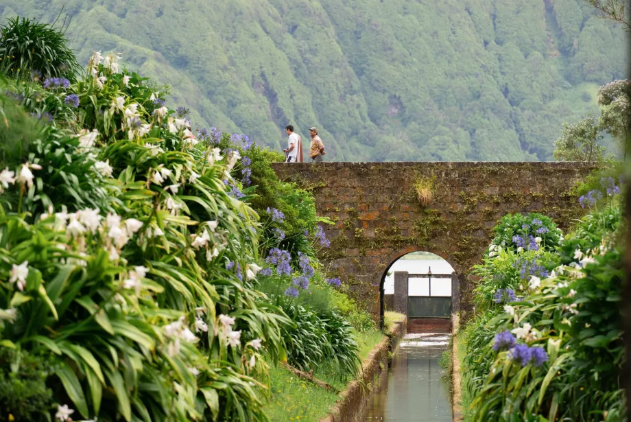
In the north-western part of Lagoa Azul, under the steep slopes of the caldera, you will come across an interesting construction work dating back to 1930. Here, a tunnel with a water tunnel cuts through the rock mass to the other side towards the village of Mosterios. It is 1 200 metres long and was used to maintain the lake level and prevent flooding.
There is a narrow walkway along the water channel that leads through the tunnel to the other side, see the route map. However, the inside is unlit, so you must carry a powerful torch.
Accommodation on the lake shore
Most accommodation can be found in the town of Sete Cidades, but if you would like to stay in the countryside directly overlooking Lagoa Azul, we recommend a beautiful holiday home Lake Cottage - Panoramic views 7 Cidades with prices around 160 eur per night, which at first glance is high above average, but accommodation is for up to 4 people.
How to get to the lake?
Which is the best way to get to Lagoa des Sete Cidades by car and do buses run here?
By car
Like everywhere in the Azores, the best form of transport is a hire car, which will give you the freedom to move to the hiking trails and around the countryside. Good quality and well maintained roads lead to the crater floor from the east and west and you can easily reach all the tourist attractions. As Sete Cidades is one of the main Azorean attractions, the signage is good and clear from all directions.
The distance from Ponta Delgada is less than 30 km.
Compare car rental prices - PDL Airport
By bus
There are also buses to Sete Cidades from Ponta Delgada and the nearby towns of Várzea and Mosterios. In total, there are approximately 4 times a day, including weekends. Current timetables are not currently available on the Auto Viação Micaelense website, usually look for them in this section.
What to see around
Discover all the places to see in São Miguel.
Any questions left?
If you have any questions or comments about the article...

