Waihee Ridge Trail


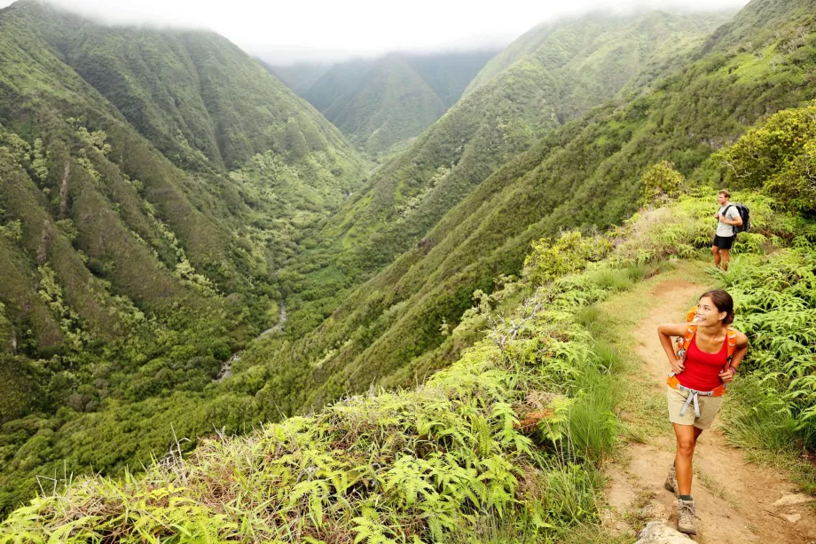
One of Maui's most beautiful hiking trails takes you through dense rainforest and deep valleys from the coastal road to the top of the mountain, above the clouds, above the fog, into absolute silence.
The cheapest accommodation on Maui
Difficulty and length of trip
The Waihee Ridge Trail is a well-trodden and relatively comfortable trail with no dangerous sections. The reason it is rated as challenging is primarily due to the high elevation gain.
In total, the Waihee Ridge Trail is about 3.5 miles one way, and you will have to return the same way, for a total of about 7 miles.
Along the entire length of the trail, you'll enjoy spectacular views of jungle-covered valleys, and for the last third, you'll enjoy a ridge hike along the edge of 782m-high Mount Lanilili.
- Length 7 km (round trip and return combined)
- Elevation 482 metres (uphill continuously there)
- Route map
How to get there
The hike winds through the mountainsides on Maui's northwest coast, and the trailhead is easily accessible by car. Driving from Kahului on Route 340, you'll reach Mendes Ranch, at which point you'll need to take a sharp left and continue on Maluhia Road.
Shortly after turning off the main road, you must open a gate, which you will immediately close behind you. You enter the farm property and the gate keeps the cattle from wandering off, but the road is open to tourists.
After about 1.5 miles, you will come to the parking lot where the Waihee Ridge Trail begins.
What to see around
Discover all the places to see in Maui.
Any questions left?
If you have any questions or comments about the article...


